We can uncover ancient history through archaeological investigations that analyse depositional soil sediments and materials derived from human activity. We offer the most suitable and applicable geophysical surveys and data analysis for rapid data interpretation, soil condition estimates and the detection of man-made objects present in the subsurface. These include archaeological artifacts, architecture, biodiversity, cultural landscapes and environmental data.
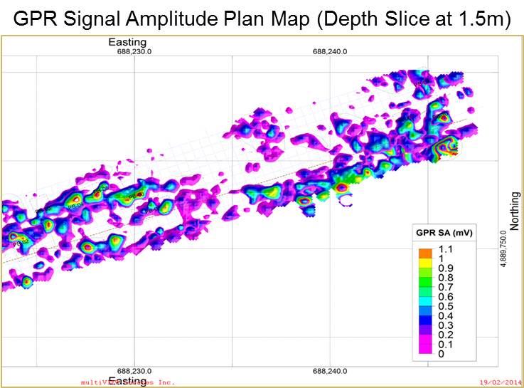
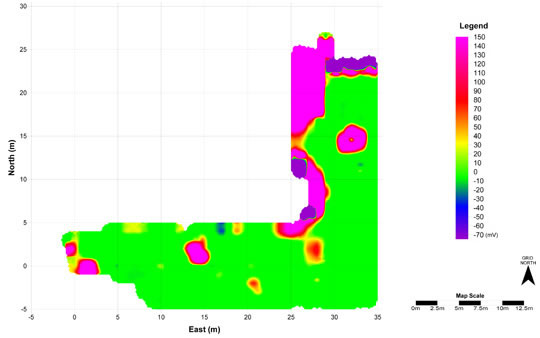
Archaeological geophysics involves methods to collect data that permits the field archaeologist to image and map underlying archaeological features, which are otherwise impossible to detect using traditional field methods. Archaeologists can take advantage of the physical and chemical changes within the ground relative to the presence or absence of subterranean objects. Using highly sensitive instruments the specialist technician can measure, map, and interpret the data signals, received by the Ground Penetrating Radar (GPR) system, into useful information for planning the excavation.
Non-intrusive Survey
The greatest advantage of GPR is that it offers non-invasive & non-destructive way to collect information about the near-surface. Large sites with concealed remains can be viewed and analysed efficiently and accurately, whilst preserving the site.
GPR maps offer useful primary survey data that can be used to establish sites for excavation or even identify sensitive areas where cultural remains, such as burial sites could be found and may need special extraction process and therefore the information can guide archaeologists to avoid disturbing or destroying these locations.
The sedimentary strata and buried artifacts have a peculiar physical and chemical composition. This influences the velocity of the Electromagnetic wave spread (electrical conductivity and magnetic permeability). Differences or variations in the waves received signify presence of objects, voids, changes in physical properties, etc. Pattern in the subsurface imaging are indicative of underlying archaeological features such as architecture or artifacts.
We offer a wide range of solutions for archaeological investigations, including:
- Ancient Underground Foundations
- Graves and Burials
- Chambers and Grouts
- Archaeological Artifacts
- Buried Objects
- Underground Tunnels