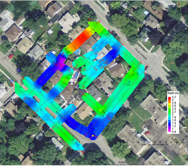
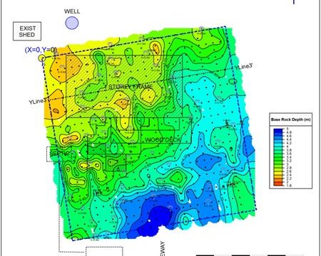
Seismic Refraction is a geophysics technique used to describe the relationship between seismic wave angles of refraction when passing through a boundary between two different isotropic media, (e.g. soil and bedrock). It is used to estimate:
- general soil types and approximate depths to strata boundaries
- water tables and/or the upper bedrock surface to be determined
- rock rippability characteristics for pre-construction planning
This technique has been successfully applied to mapping depth to the base of backfilled quarries, depth of landfills, the thickness of overburden, and the topography of groundwater.
How does Seismic Refraction geophysics work?
Seismic Refraction surveys commonly involve laying out a spread of geophones in a straight line, with seismic impact source points positioned with and off the ends of the geophone spread.
Seismic Refraction involves measuring the travel time of the component of seismic energy which travels down to the top of a rock (or other distinct density contrast), is refracted along the top of rock, and returns to the surface like a head wave along a wavefront. The shock waves which return from the top of the rock are refracted waves, and from the geophones at a distance from the shot point, always represent the first arrival of seismic energy.
It is generally applicable only where the seismic velocities of layers increase with depth. Therefore, where higher velocity (e.g. clay) layers may overlie lower velocity (e.g. sand or gravel) layers, seismic refraction may yield incorrect results. This technique is commonly limited to mapping layers that occur at depths less than 100 feet.
Greater depths are possible, but the required array lengths may exceed site dimensions, and the shot energy required to transmit seismic arrivals for the required distances may necessitate the use of very large explosive charges. In addition, the lateral resolution of data degrades with increasing array length since the path that a seismic first arrival travels may migrate laterally off of the trace of the desired seismic profile. Recent advances in the inversion of seismic refraction data have made it possible to image relatively small, non-stratigraphic targets such as foundation elements, and to perform refraction profiling in the presence of localized low-velocity zones such as incipient sinkholes.
What is Seismic Reflection?
Seismic Reflection is a method of geophysical exploration that uses the principles of seismology to estimate the properties of the Earth’s subsurface from reflected seismic waves. The method requires a controlled seismic source of energy, such as a specialized air gun or a seismic vibrator, commonly known by the trademark name Vibroseis. By noting the time it takes for the reflection to arrive at a receiver, it is possible to estimate the depth of the feature that generated the reflection.
Seismic Reflection vs. Seismic Refraction
Seismic reflection uses field equipment similar to seismic refraction, but field and data processing procedures are employed to maximize the energy reflected along near-vertical ray paths by subsurface density contrasts. Reflected seismic energy is never a first arrival, and therefore must be identified in a generally complex set of overlapping seismic arrivals.
Therefore, the field and processing time for a given lineal footage of seismic reflection survey are much greater than for seismic refraction. However, seismic reflection can be performed in the presence of low-velocity zones or velocity inversions, generally has lateral resolution vastly superior to seismic refraction, and can delineate very deep density contrasts with much less shot energy and shorter line lengths than would be required for a comparable refraction survey depth.


