Overview – Mapping Bedrock Depth
Construction and design engineering activities requiring bedrock depth data benefit regularly from geophysical site evaluations. Whether budgeting for road construction or planning for a backyard pool, identifying the extent and location of bedrock prior to excavation can significantly reduce project cost overruns. Brownfield facility design projects can alter utility and structure locations often eliminating costly blasting operations.
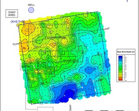
multiVIEW regularly performs geophysical site evaluations to determine overburden stratigraphy through Ground Penetrating Radar (GPR) and Seismic surveying. These techniques work by pulsing electromagnetics and sound, respectively, through the subsurface and measuring the reflecting energies and subsurface profiles. Below is an example of a bedrock surveying project using Ground Penetrating Radar. Click on any image to expand.
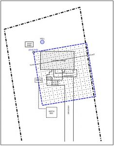
Proposed Property Map with Survey GPR Grid Layout
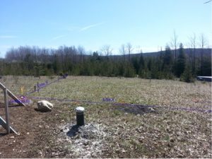
GPR Survey Grid Layout Photo
Contour Grid Map

GPR Interpreted Cross Section YLine3-Yline3
