Quality Field Data Informs Safe, Efficient Project Design and Construction!
As infrastructure ages and populations grow, there is a greater need than ever before for accurate, quality field data to inform safe, efficient project design and construction. To ensure project success, this data must be effectively shared among various project stakeholders. The benefits of accurate, accessible data are immeasurable and include minimized utility damages, less downtime, avoidance of claims and liability, and informed decision making.
For more than 30 years, our in-house team of project engineers, geophysicists, CAD and GIS experts have been integrating and analyzing data to produce highly visual mapping products that provide the insights you need to make informed project decisions. Our data services include:
- Establishing and managing your records databases, while providing a live data updating service to ensure that you are always working from the latest information. This service is ideal for supporting asset management plans, or keeping track of work progress. An integrated, accurate records database saves money in the long run, by providing information you can count on and minimizing the need to verify data
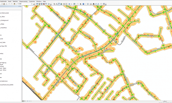
- Integrating collected data into highly visual CAD drawings that are customized to your specific project requirements. These drawings can be overlaid on Google Earth imagery, included as a GIS layer, converted into GIS feature classes and provided in many other formats
- Leveraging Esri’s ArcGIS to integrate, analyze and display attributes captured in the field, and georeference these attributes in a GIS database. We can also convert CAD drawings into GIS feature classes, and associate drawings to GIS features. This data can then be easily shared among multiple stakeholders as well as leveraged for future projects
- Creating contour grid maps that depict bedrock topography, water table depths, base rock stratigraphy, road structure, asphalt and pavement thickness, among many other features
- Developing 3D visuals that showcase voids, rebar, conduits and other features buried in concrete
- Producing highly detailed maps that highlight soil contamination, map landfill sites, uncover minerals, highlight targets for groundwater supply, identify geological hazards, locate tree roots or reveal Underground Storage Tanks and other buried assets

multiVIEW integrates collected data into highly visual CAD drawings that are customized to your specific project requirements. We can also convert CAD drawings into GIS feature classes, and associate drawings to GIS features.

multiVIEW establishes and manages your records databases, while providing a live data updating service to ensure that you are always working from the latest information.
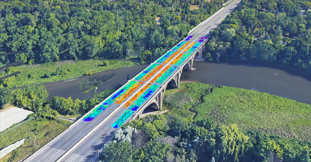
Our diversified services involve creating contour grid maps that depict bedrock topography, water table depths, base rock stratigraphy, road structure, asphalt and pavement thickness, among many other features.