Background
multiVIEW was retained to carry out Borehole Electromagnetic Induction Logging and Conductivity Monitoring for a Regional Landfill. The primary objective of the survey was to measure electromagnetic responses in a series of monitoring wells located within the landfill property and adjacent properties, as part of an environmental monitoring program. Data acquired in 2011 and 2015 were compared to data acquired in 2017 to identify areas that may have been impacted by the operations of a waste disposal facility.
Methodology – Conductivity Monitoring
The project consisted of measuring the conductivity of the soil in newly installed monitoring wells using borehole electromagnetic logging. A base map depicting the position of the wells was provided by the client and data acquisition was performed using a Geonics EM39 Borehole Conductivity Logger and Probe. Data was acquired at a station spacing of 20 centimeters from ground level to the full depth of each monitoring well.
Mapping the conductivity made it possible to infer the location and extent of different waste materials and leachates (liquids that drain from a landfill). Metallic utilities were located by looking for positive peaks or anomalies in the data which are typically representative of metallic masses.
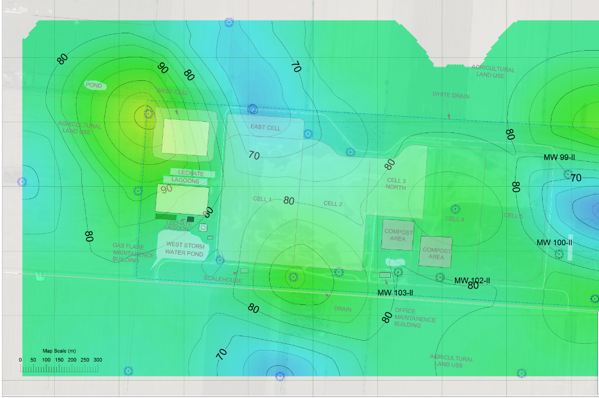
Findings
Processed borehole conductivity data was presented in a series of profile plots overlapped to the borehole stratigraphic sections along the trace of the investigated wells. Comparing acquired data with historic data from 2011, 2015 and 2017 made it possible to identify zones of potential leachate migration.
Areas with a conductivity change of >80 mS/m were interpreted to be anomalous zones. Homogeneous responses (with values of <50 mS/m) along the geological section, and with subtle conductivity change indicated unaltered soil conditions.
Data was displayed in an anomalous conductivity contour grid map and compared with historic data from 2011 and 2015 to identify anomalous conductivity zones and zones of potential leachate migration.