
Safety, Quality, Customer Excellence since 1989.
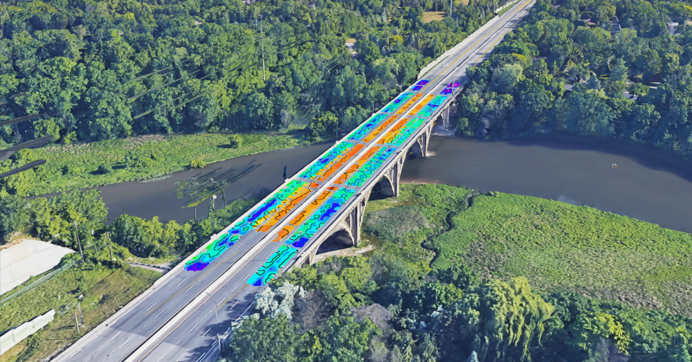
Geophysical Surveying
Make sound project investments with accurate and comprehensive subsurface insights. We offer a wide range of geophysical surveys for investigating geological and manmade subsurface conditions, such as Infrastructure Management, Contaminant Plume Mapping, Underground Storage Tank (UST) Detection, Depth to Bedrock Investigations, and more.
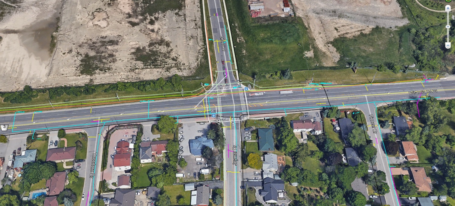
Subsurface Utility Engineering (SUE)
Effectively manage project risks associated with utility mapping, design, coordination and relocation to keep your project moving on time and within budget. Backed by 30+ years of progressive experience, we offer all Quality Levels of SUE from D-A: Records Research, Field Survey, Utility Locating, Utility Daylighting (Hydrovac Excavation).
Learn more about our Subsurface Utility Engineering (SUE) Services →
Subsurface Utility Engineering (SUE)
Large scale infrastructure projects require large scale planning. Every project starts with the collection of accurate data, and complex utility information isn’t the exception.
How to implement a Subsurface Utility Engineering (SUE) Program →
CCTV Pipe & Sewer Inspection
Reliable and cost-effective method of inspecting and assessing the condition, location and path flow of sewer pipes to preserve the health, safety and lifecycle cost of sewer systems. Out NASSCO-certified team will ensure inspections are performed to the highest standards every time.
Learn more about our CCTV Pipe & Sewer Inspection Services →